
“Abia-Anambra boundary stretches about 23 kilometres, with the two states agreeing on 15 kilometres.”
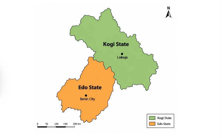
The Edo and Kogi states boundary disputes have remained unresolved due to vanished landmarks, competing claims and community resistance.
He said technical and administrative efforts had produced an approved boundary line, but implementation faced resistance from communities along the corridor.
Meanwhile, Mr Adaji said the commission recorded progress on the Abia-Anambra boundary, with 15 kilometres of the 23-kilometre stretch already agreed upon.
According to Mr Adaji, the Edo-Kogi boundary was defined under Legal Notice No. 126 of 1954, which established the boundary between the Northern and Western Regions.
He said some physical features referenced in the document had disappeared over time, making it difficult for experts to accurately trace the boundary.
Mr Adaji said technical experts had attempted to interpret the historical documents, but the disappearance of landmarks introduced subjective judgment into determining the boundary.
“This has led the parties to continue laying claims in different areas,” Mr Adaji said, recalling efforts dating back to 2006 to establish the boundary.
He said the commission considered the claims of both states and eventually produced a line regarded as the boundary between Edo and Kogi.
Mr Adaji said the proposed boundary was subsequently approved by the Internal Boundary Committee, paving the way for its physical demarcation.
However, the NBC boss said the exercise encountered resistance when the contractor moved to establish the approved boundary on the ground.
He said communities along the corridor objected, arguing that the proposed line did not correspond with their understanding of the boundary.
“The affected communities consequently resisted the demarcation, prompting the commission to engage stakeholders and seek broader agreement,” he said.
Mr Adaji said the parties met again earlier in the year to determine how the approved boundary could be physically established and assess its implications.
He said the agreement was challenged after some parties withheld full cooperation and presented documents indicating possible changes to the boundary.
“Some documents included court judgments that have not previously been brought to the commission’s attention.
“We have to examine these issues and engage the states so that we can arrive at a common understanding,” he said.
Mr Adaji said the Edo-Kogi boundary process remained ongoing, adding that the commission had agreed to commence demarcation when resources became available.
“We are still looking for the resources to undertake it.
“Where challenges arise, we will address them as we encounter them,” he said.
NAN reports that the Edo–Kogi boundary dispute involves Ogori–Ekpedo, Okene–Okpella, and the Ake axis, where boundary interpretation and demarcation remain contested.
NAN also reports that the NBC is addressing farmland disputes between Ibaji communities in Kogi and Uloshi/Esan South-East in Edo, alongside the broader interstate demarcation.
Turning to Abia-Anambra, Mr Adaji said the two states shared close cultural and ethnic ties, with communities on both sides maintaining strong social relationships.
He explained that their boundary emerged from colonial-era divisions that were not adequately documented or clearly defined, creating room for competing claims.
“Abia-Anambra boundary stretches about 23 kilometres, with the two states agreeing on 15 kilometres, leaving approximately eight kilometres unresolved,” he said.
Mr Adaji said communities along the remaining eight-kilometre corridor had maintained strong claims and counterclaims over particular areas.
He said one state could accuse communities from the other side of developing disputed land to create an impression of annexation.
According to him, the commission secured agreement from both states to support efforts aimed at resolving the outstanding eight-kilometre stretch.
Mr Adaji said the states met with the commission in July and agreed to support fieldwork to re-establish the disputed boundary.
He said the exercise could initially produce two lines reflecting the respective claims before eventually arriving at one clearly defined boundary.